Saturday, 20 August 2011

Google adds the Amazon River to 'street view'

This is just a short post, that I thought I should mention, as I discovered recently that Google begins photographing the Amazon for Street View. For those not familiar, Street View provides the user will a full 360 degree view of a point on the map, the user is then able to jump into another 360 to see the next stage. This is relatively seamless, so it feels like you are actually moving along the river.

This should be interesting for any of our environmental orientated academics and students. This will effectively allow students to view the Amazon River as if travelling down it on a boat. Worth keeping an eye out for this project - I think you can expect others to follow.

Thursday, 18 August 2011

Testing Toshiba Technologies

I was lucky to stumble across a Toshiba demonstration today (at Plymouth University), a chance to play with some new technologies. It included a mix of their laptops and also the new Qosmio F750 Toshiba Laptop 3D. Which interestingly requires no 3D glasses (a bit like the Nintendo 3DS). Where it differs to most 3D systems is that the webcam follows your eyes in order to obtain the best 3D effect. Interestingly if too many people crowded the screen it made for a more confusing picture. That said, it was very impressive and even at odd viewing angles there was some 3D effect. I felt the overall image made the characters, backgrounds and foregrounds in the film feel a bit like flat animated 2D objects placed at varying distances, although the depth of field was certainly effective. I cant say at the moment that I'm convinced with 3D, its a big improvement over older attempts, but it still looks a bit synthetic. There is of course the concern that some may still feel a bit nauseous watching for any length of time.

They also brought along the Toshiba Thrive tablet (pad), using Android 3.1, which I was pleased to see. It was relatively quick and smooth, but probably not quite up to its competitors, such as the Asus EeePad and Motorola Zoom. I felt the screen was a little washed out, but this is only a minor point. It had a range of connectivity including SD Card, HDMI, USB and the ability to swap batteries easily (the back cover could be changed to any colour you like). It was claimed that battery life was around 8 hours, but there was no means of testing how well that worked today... Thanks to all involved for letting me crash the party...

Wednesday, 17 August 2011

Applying for Adobe Distribution Licence

I have been investigating software licences for the Hydrographic Academy project as teaching materials will use a fair amount of offline software and applications. Some of the learning object run on Adobe Flash and students would need Acrobat (for PDF files) - I cant assume they will all have good internet connections! After some asking around and investigating on line, I came across the Licencing area on the Adobe website. I thought it was going to take several days to get a response, but most of it was in fact automated. I suspect the final stage required an OK from 'a person' but this was not clear, as I actually recieved licencing permission for distributions via DVD/USB drive within 10mins.

It looks like this process has to be repeated yearly, filling out the same form again.

Tuesday, 9 August 2011

The Hydrographic Academy Blog goes live!


It has taken a fair amount of collaborative work, but I'm very pleased to announce that the Hydrographic Academy blog has now gone live!

This blog will feature details on how the Academy is developing, updates on course materials and even a few post on the technologies used to deliver content to the site. The Hydrographic Academy is in it's infancy at the moment, but more information can also be found on the HE STEM website.

I went for the blue HA logo colours and decided on a grid effect as the concept of surveying very much revolves around maps and plotting. The wave effects were to express a sonar/sonic elements of surveying, so I used a variety of sinusoidal and slightly more complex sound waves to create this pattern, which I felt encompasses this very well. All of the background was achieved in Adobe Photoshop CS5.

Saturday, 9 July 2011

Offline mapping for fieldwork? - Google Maps for Android

For many years now I have been using and advocating offline mapping software for fieldwork in technology enhance learning applications. This is software that does not rely on any internet connection and allows the user to add their own maps in GPS based applications. Why? Well there are many occasions that using a map in a remote location becomes an issue because there is no data connection. The reality is that if anything is going to hinder students learning, it's waiting for a map to load...

So I was very very pleased to find that 'Google Maps for Android' are now allowing several square mile sections of maps (as explained in this article) to be saved on your mobile device. At the moment I have no idea how well this will work, as its only just been released. But this is how it works for those interested in trying:
  • Update your Google Map to the latest version.
  • Open 'Maps' on your android device > press Menu > More > Labs (Labs are test area for applications Google are experimenting with) > Download map area
  • Once active simply click and hold in a central point of your chosen location
  • Open the icon that appears and select the bottom option 'Download map area'
  • It will show it is downloading and then a black square border will appear showing the area that is saved to your device. It should still show your map with both data and Wifi turned off!
Sadly it only downloads basic road maps, so no satellite maps available (but its a fantastic start!) Lets hope this trend moves onto the other mapping services such as the excellent educational sources provided by Edina. This could really help education for many science and technology based fieldwork locations here at Plymouth University!

Google if you're listening, the ability to download satellite maps or even to use my maps (my spaces) with way-points etc included would be fantastic!

Friday, 8 July 2011

Geospatial Focus Group


Today I attended the first Geospatial Focus Group here at Plymouth University. Anne Mather an Associate Professor (Reader) in Physical Geography, School of Geography, Earth and Environmental Sciences (Faculty of Science and Technology) came up with the idea to combine ideas, knowledge and data with a range of individuals both internal and external of the the Faculty. The topics ranged from the following (Plymouth University staff):

Tim Absalom (Geography, SoGEES). Digimap
Richard Hartley (Geography, SoGEES) Hardware and software available for collecting and manipulating Geospatial data in Geography.

GIS resources in teaching/research (with emphasis on the cheap and simple!):
Victor Abbott (Marine Science and Engineering) Hydrographic survey
Sarah Boulton (Geology, SoGEES) River Tools
Martin Stokes (Geology, SoGEES) Landserf
Anne Mather (Geography, SoGEES) Google Earth

Also included were guest presentations in the use of Geospatial data beyond education, both extremely interesting. Thank you to both speakers!:
Commander Andrew Swain (FOST HM), Devonport

A very large array of topics. I'm always amazed how all these areas overlap in terms of how they recorded and publish data. Of course, from a learning technologist perspective I was rather keen to see how staff used their geospacial resources for teaching, meetings like this are invaluable for getting an idea of what your clients may ask you in the future!

Keith Westhead briefly introduced the very handy and excellent iGeology mobile application that is available for both iPhone/Pad and Android devices. This software relies on pulling down their geological map via a 3G data connection or similar in relation to the GPS location provided by the mobile device. As long as you have a fast data connection it works brilliantly. Having had some difficulty using any data derived mapping system such as this in 'very' remote locations, I asked if they were planning to make cached or small maps tiles available to download for use offline (contained within the programme, to ensure copyright issues). Apparently they have not, but he said that this was a good idea and would take this back to BGS and the software developers as a possible feature. I hope that they do! there is a lot of scope for such functionality in fieldwork.

Digimap aside, the availability of 'digital maps for mobile devices' (in education contexts) could be an option, so educational software developers can incorporate these maps into their own digital training material. Ideas like these are out of our hands but hopefully organisations such as BGS will consider the wider marketing advantage and offer such services.

Cdr Andy Swains presentation, on the Royal Naval approach to using hydrographic mapping and land surveying was very interesting (we are talking life and death situations! The data has to be good!), its fascinating how different organisations utilise technologies for their benefit.

A great set of talks from everyone, I will certainly be looking forward to the next meeting.

Thursday, 7 July 2011

Vice Chancelors Conference @ Plymouth University 2011

IMG_1410IMG_1407IMG_1408IMG_1409IMG_1411IMG_1412 IMG_1413IMG_1414IMG_1415IMG_1416IMG_1418IMG_1419 IMG_1420IMG_1421IMG_1422IMG_1423IMG_1424IMG_1425 IMG_1426IMG_1427IMG_1428IMG_1429IMG_1430IMG_1431

VC Conference 2011, a set on Flickr.

Following on from the TEL showcase day, was the VC's conference, this was again a display of what Plymouth University had to offer in respect to Teaching and Learning, of course there was a little TEL thrown into the mix. This was very much reflected in the Teaching Fellowships awarded and prevalent in the many sessions sharing and discussing Open Educational Resources. These are just a few photographs that capture the day.

Wednesday, 6 July 2011

TEL Showcase 2011

IMG_1382IMG_1383IMG_1384IMG_1385IMG_1386IMG_1387 IMG_1388IMG_1389IMG_1390IMG_1392IMG_1393IMG_1394

TEL Showcase 2011, a set on Flickr.

The technology enhanced learning team again ran another successful show and 'TEL' (as Dr Neil Witt puts it) of all the exciting things being done using technology to enhance learning. Practitioners and developers alike all showed there wares, with 3 paralleled sessions with workshops running throughout the day. Plymouth is certainly becoming a very creative hotspot for TEL development.

Tuesday, 28 June 2011

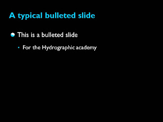
A PowerPoint Template for the Hydrographic Academy

I have been doing a fair amount of work on creating a template for the Hydrographic Academy for both presentations and also for content creation in PowerPoint 2010. The latter would be used within the Mohive interface I have discussed in earlier posts. I felt it very important that the
Hydrographic Academy identity is carried throughout and provided in a professional manner. The main structure is black or white backgrounds, simple clean lines and a sans serif text to suit the Disability acts. I went for the HA blue, as we are now calling it, for the text colour (when used on a black background) and plain black text on white as an alternative. Black backgrounds lend themselves well to excellent contrast; generally are used in video productions; are predominately easier to read in low lit conditions; and on certain devices use up less battery power on back lighting (so to speak).

Bullets were designed with the white and blue from the logo in mind.

Why the simplicity? This is a personal view, but I often feel that PowerPoint templates have a tendency to age rapidly. Going for simple fonts and lines are less likely to age and it gives it as more established and classic look. I also think this looks much more professional to the end users.

Transitions are basic wipes (nothing to tacky please...) and a rather nice water ripple effects for starting screens. We are in discussions on whether to add the HA logos in certain parts of the slides, but no decisions as yet. Undoubtedly this is not the very last version (as I'm always in talks with our content developers experiences of using the template), but I thought this closely resembles the most likely version for the future. I'm atticipating this will feature in many a presentation before any content is released in Mohive, at least it's a taster of what is to come...


Saturday, 18 June 2011

YouTube adds Creative Commons for uploads

I was interested to find that YouTube now has a Creative Commons option for their uploads. The ability to share content with others and also allow them to adapt for their own needs it good for all open source users, this addition is certainly an added bonus. Although as pointed out by a colleague this does not include the Non-Commercial (NC) part, which your educational establishment or company may prefer, not forgetting those wishing to make money from their work.

Looking at the details provided by Youtube it quotes:

For more information on the CC-BY license—a summary of the full Legal Code with the full license accessible at the bottom of the page—please visit this page on CreativeCommons.org.

This creative commons page actually states its an:
Attribution 3.0 Unported (CC BY 3.0)

You are free:

to Share — to copy, distribute and transmit the work
to Remix — to adapt the work
to make commercial use of the work

Under the following conditions:

Attribution — You must attribute the work in the manner specified by the author or licensor (but not in any way that suggests that they endorse you or your use of the work)...
If your dont want other companies using your content, then probably steer clear of this option, it may not be the best option. Perhaps YouTube will also provide an option that has NC in the future? Could be handy.